

Unmanned Aerial Vehicles
ANR Educators in Drone Program
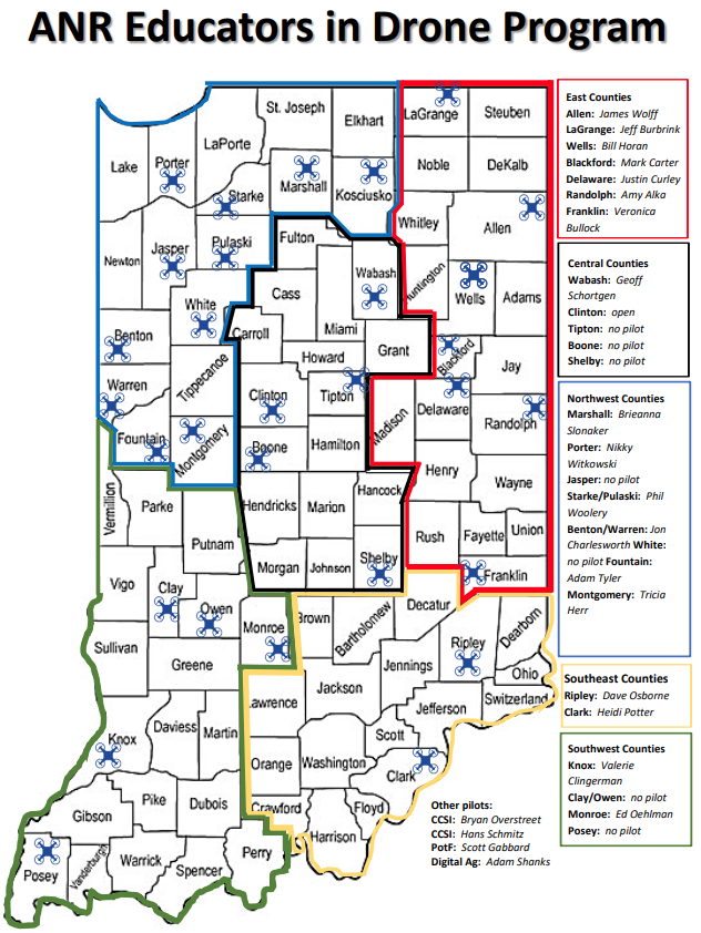
This map shows the Indiana counties that have Agriculture and Natural Resources (ANR) educators participating in the Purdue Extension Drone Program. Counties are grouped into five areas: East, Central, Northwest, Southeast, and Southwest. Within each area, specific counties have drone pilots, and the educators assigned to those counties are listed below. The map also identifies additional drone pilots affiliated with statewide programs.
Contact Us
Mark Carter or Adam Shanks @ extuav@purdue.edu
List of counties by Extension Drone Program Area:
East Counties
- Allen
- Blackford
- Delaware
- Franklin
- LaGrange
- Randolph
- Wells
Central Counties
- Boone
- Clinton
- Shelby
- Tipton
- Wabash
Northwest Counties
- Benton
- Fountain
- Jasper
- Marshall
- Montgomery
- Porter
- Pulaski
- Starke
- Warren
- White
Southeast Counties
- Clark
- Ripley
Southwest Counties
- Clay
- Knox
- Monroe
- Owen
- Posey
Other Pilots
- Scott Gabbard (PotF)
- Bryan Overstreet (CCSI)
- Hans Schmitz (CCSI)
- Adam Shanks (Digital Ag)