

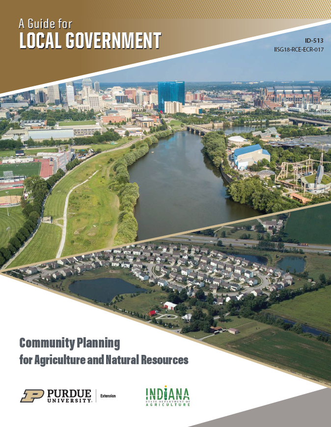
Community Planning for Agriculture and Natural Resources: A Guide for Local Government
Community Planning for Agriculture and Natural Resources: A Guide for Local Government is available as a free, downloadable electronic resource. The series was funded by the Indiana State Department of Agriculture and developed by Purdue Extension and the Indiana Land Resources Council.
The entire series can be downloaded as a PDF at no cost. To purchase a printed copy, please visit the Purdue Education Store.
Each section of the guidance document series is described below, with a direct link to a downloadable PDF.
For questions, please contact Kara Salazar at salazark@purdue.edu.
GUIDEBOOK SECTIONS

Purdue Extension and the Indiana Land Resources Council collaboratively developed this guidance document to support plan commission members as well as local government officials and staff — with resources and examples to integrate agriculture and natural resources into community land use planning efforts for developing or updating comprehensive plans.
Each document in the series provides an overview of the topic, economic development considerations, community examples, and resources to make connections for local planning efforts.
Funding for this project was provided by the Indiana State Department of Agriculture. No information in this project or any of its components should be construed as legal advice, nor should any legal action be taken without consultation of an attorney. The information herein is intended to be educational and informational in nature, in accordance with the statutory mission of the Indiana Land Resources Council, IC 15-12-5, as administered by the Indiana State Department of Agriculture.
Public Participation
Due to the technical nature of planning for agriculture and natural resources, residents and stakeholders bring varying degrees of knowledge, training and information to the planning process. This section advises on how to engage residents and other stakeholders early in a process to provide input for a local agriculture or natural-resources planning effort. Such engagement is important for building trust and communicating how the community will look and function in the future. Public participation can be any process that directly engages members of the public in decision-making and gives consideration to their input in the final decision.

This section provides an introduction to basic concepts of economic development and how they are related to land use planning. These include asset-based economic development, the community balance sheet, and the three-legged stool. The focus then turns to common economic development goals for communities, and strategies for land use and local policy to consider when planning for each economic development goal.

Natural Resources and Community Health
This section focuses on how a comprehensive plan can be used to provide opportunities for active living through deliberate planning policies and regulatory tools for parks, trails and open space. Identifying natural-resource assets in a community and planning for their use can also create economic development benefits. In this context, we consider natural resources to include public and private undeveloped land that could be used or acquired by a parks system/municipality, community group or developer. The land should also be accessible to the public so that benefits of active living can be shared.
Renewable Energy Integration for Sustainable Communities
Renewable energy installation has seen a significant increase, especially with a movement from small-scale, individually owned projects to utility-scale projects that feed into the main transmission grid. Renewable energy, such as wind, solar and biomass, is installed for many reasons. This section reviews the careful considerations necessary to determine if a renewable energy project is right for a community in terms of access to the electricity grid, economic payback and policy considerations.
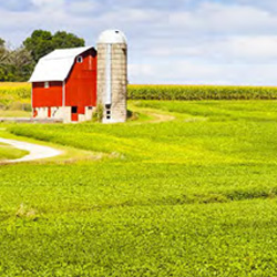
Importance of Indiana Agriculture
More than 60% of Indiana’s land is devoted to agriculture production via 56,800 farms and 14.7 million acres. Today, most farms are not engaged in subsistence farming, meaning that fewer individuals interact with daily efforts associated with raising or growing agricultural products. Therefore, the appreciation of agriculture’s place within the larger Hoosier economy — urban and rural — has diminished. This section provides a big-picture view of Indiana’s flourishing agriculture industry and recommends ways in which local government can incorporate goals and policies concerning agriculture in its comprehensive plans. Check the latest up-to-date data and ag census update
Livestock Production and Planning: Confined Feeding Operations
Livestock production has changed over the last few decades but still plays a large role in Indiana from standpoints of economic benefit and cultural tradition. This section addresses confined feeding operations (CFOs) specifically in terms of their benefits and the challenges sometimes associated with integrating livestock production into community planning. Finally, it describes several available tools and resources for planners and communities wishing to address CFOs.
Aquaculture
This section provides an overview of aquaculture, a significant component of Indiana’s agricultural economy. The underwater farming method produces fish for human consumption, recreational fishing, and ornamental display. There are diverse fish species produced in Indiana, and several state-wide resources to continue developing the industry, such as vacant farm buildings, large open ponds, and water bodies. Aquaculture provides Indiana citizens with sustainably produced, local, and fresh food, creating a healthy environment and benefitting local communities.
Local Food Systems
Communities interested in supporting local food infrastructure can include this support in their comprehensive and other local government planning efforts. Efforts to do this have been termed “local food system development.” This term refers to food that is produced in an area, whether it is a town, city or region. Acknowledging that all types of agriculture have value, a community can encourage additional development of local food-focused efforts through their policies, ordinances, zoning and related planning and regulatory tools. This section provides an overview and background of food systems, local planning considerations, policy and ordinance examples, and additional resources.
Indiana Site Certified Program
This section outlines the Indiana Office of Community and Rural Affairs’ (OCRA) Indiana Site Certified program — which designates sites that are well positioned for economic development. Indiana recognizes three tiers of readiness: Silver, Gold and Prime. Certified sites are featured on Indiana’s Site Selector Database and included in marketing materials for the Indiana Economic Development Corporation (IEDC). Communities of any size are eligible to apply for this certification, and applications are accepted on a rolling basis.
Site Considerations for the Rural Economic Development Model
This section highlights features of the Rural Economic Development Model developed by the Indiana Economic Development Association’s Rural Economic Development Affinity Group. Agriculture and ag-based business might require a different infrastructure footprint than other industry. Depending on a community or region’s agribusiness target, requirements for water, waste-water capacity, road surface and capacity, rail service, and bridge width and structure might all be unique. It’s critical to connect infrastructure requirements to ag-based economic development targets upfront. Relying on available resources can be a significant advantage. The planning and identification of specific industry needs should come together in each community, resulting in development of sites that meet unique needs for ag industry targets.
Land Use Tools for Preserving Farmland
Across Indiana, open space contributes to the look and feel of communities while providing amenities and resources. Open space is simply undeveloped land, and it can include such amenities as parks and golf courses, fields and pastures utilized for production agriculture, or natural areas such as woodlands and wetlands. Planning with open space in mind helps communities preserve these resources. This section focuses on farmland preservation and provides additional open-space planning resources.

Agritourism as a business model is growing in popularity as Indiana farmers recognize a need to diversify operations and supplement farm incomes. In addition, there is a growing public desire to engage in rural experiences and outdoor recreational activities. By combining agriculture and tourism, agritourism offers these experiences and activities while providing economic diversification to farmers. Planning for agritourism requires a forward-thinking, locally driven process. Planners must acknowledge agriculture as a land use and a business. The Indiana Land Resources Council (ILRC) designed this section for agritourism operators, community leaders, extension educators, and rural economic development and tourism professionals.

Urban Forestry Comprehensive Planning Guide
Urban forestry is a program that invests in the future of the community. Your final plan should consider the biological, management and community needs in order to establish the best policies. Trees provide many benefits to communities. These can include aesthetic qualities, such as the beauty of flowers and fall colors, or functional benefits, including shade, storm water management and filtering pollution for cleaner air and water. All of these qualities combined are called ecosystem services.
Invasive Species Considerations in Community Plans
Non-native plants, animals and other pests can cause harm to native natural resources. Invasive species are often spread by humans during their daily activities and present significant economic, ecological and, in some cases, health-related challenges to communities. This section shows how, through careful consideration, the harm of invasive species can be lessened and their negative environmental and economic impacts reduced.
Forests as a Consideration in Community Planning
Forests occupy about one-fifth of Indiana’s land area and provide economic, environmental and societal benefits that help improve living standards statewide. This section examines direct economic benefits derived from the wood products and outdoor recreation industries, which produce billions of dollars of economic activity and associated employment. It also outlines additional environmental benefits, such as habitat for wildlife, soil and water conservation, biologic diversity and resilience, shading and windbreaks, and noise and odor reduction. Lastly, it covers the societal benefits of aesthetically pleasing landscapes to communities — namely positive effects of forests and natural areas on mental and emotional conditions and how attractive landscapes help people consider communities in which to live and work.
What is Pollinator-Friendly Solar?
Pollinator-friendly solar sites take an alternative approach to site design and management by using low-growing seed mixtures that stabilize soil while also providing a meaningful amount of value to pollinators, project owners, and the community. This section incudes an overview of pollinator-friendly solar, benefits and challenges, planning considerations, seed mix examples, and additional resources.
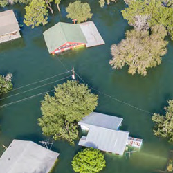
Local Government Flood Policy Tool Kit
FEMA defines localized flooding as “smaller-scale flooding that can occur anywhere in a community.” Localized flooding is most common in areas with high groundwater or poorly drained soils, where urbanization and impervious surfaces have increased runoff or in older sections of communities where original storm sewers were not designed with today’s standards.
Tool Overview: Flood Vulnerability Assessment for Critical Facilities
This section provides an overview of the Flood Vulnerability Assessment for Critical Facilities tool. It is available online to help critical facilities in Midwest communities evaluate preparedness for the next big rainstorm and consists of a series of questions to determine risk based on such factors as its proximity to a floodplain, past flooding issues, stormwater drainage structures, and the location of backup generators, servers and other critical systems. Facilities also can use the tool to evaluate current emergency communication plans for heavy rainfall and determine any necessary improvements. After completing the assessment, users receive a report with specific recommendations and resources for steps to reduce a facility’s vulnerability to riverine and/or urban flooding.
Indiana Embankment Dam Hazards Largely Unknown and Under-appreciated
This section discusses hazards and safety consideration information related to embankment dams in Indiana. Under current Indiana code for embankment dams (IC 14-27-7.5), dam owners are responsible for the operation, maintenance and safety of their dams. There are very few local ordinances, and no state codes, that address zoning, land use and permitting for lands within dam-failure flood-risk areas downstream from embankment dams that are typically larger than the 1% chance floodplain limits. Those currently living within flood-risk areas downstream of dams may be unaware of the risk these dams pose to their lives and properties.
Recent News
FEMA defines localized flooding as “smaller scale flooding that can occur anywhere in a...
Urban forestry is a program that invests in the future of the community. Your final plan should...
Agritourism as a business model is growing in popularity as Indiana farmers recognize a need to...
More than 60% of Indiana’s land is devoted to agriculture production via 56,800 farms and...
This section focuses on how a comprehensive plan can be used to provide opportunities for active...
This section provides an introduction to basic concepts of economic development and how they are...