Field Fire Damage Measurement
The fall of 2024 was one which will live in our memories for years to come. This particularly warm and dry harvest season kicked off a fast-paced harvest, and it continued through to the finish line. Grain moisture was low, and soil conditions favorable for several weeks of non-stop fall work.
These dry and warm conditions also made several not-so-fond memories for others as many farmers experienced in-field fires. The warm, dry, and often windy conditions, coupled with long continuous hours of operations often provided the perfect conditions for fires to develop and rapidly spread. This unfortunately resulted in loss of crops, machinery, and some cases life.
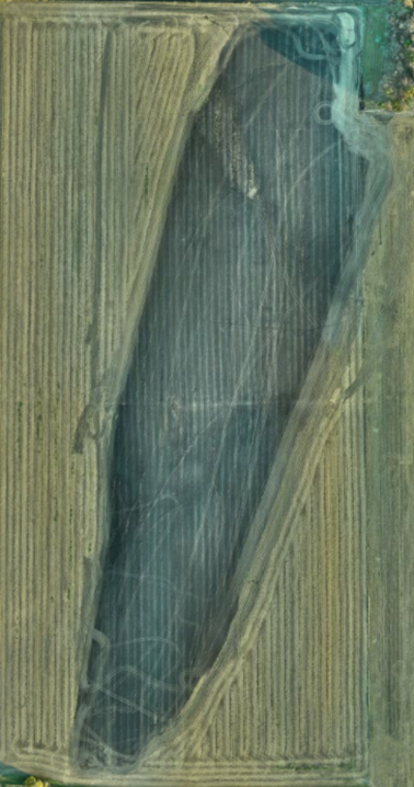
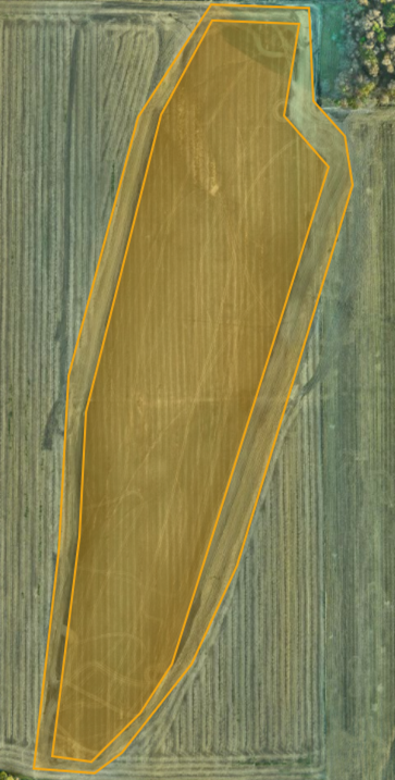
This particular fire was sparked on the south end of the field as a result of a machinery repair. The spark ignited the corn residue, and quickly spread north and east through the dry crops, driven by the swift wind. The producer was curious how much crop was lost by the fire, and by tillage equipment working to build a buffer to contain the fire. Once the field was mapped and images collected, all the data was processed through our software. Utilizing the area measurement tools available in the post-processing tool box, it was determined that the area damaged by fire equated to 28.76 acres with an additional 10.92 acres removed by tillage. The total area of damage was 39.68 acres.