

State Fair Map
Top 6 Spots to find Purdue Extension at the 2026 State Fair
- 4-H Exhibit Hall
- Centennial Hall
- Indiana Farmers Coliseum
- Purdue Extension Building
- Blue Ribbon Hall
- Champion Pavillion
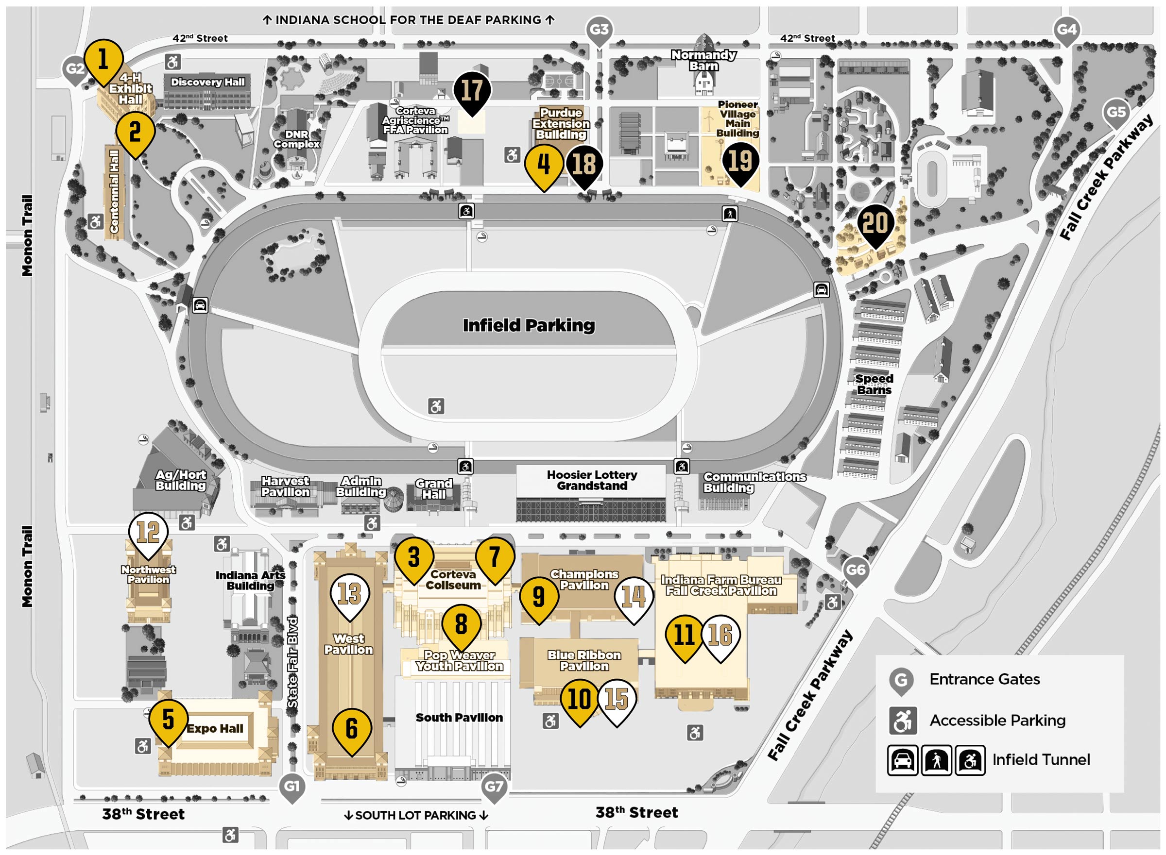
Map description (text version of the 2026 Indiana State Fair map)
This map shows the layout of the Indiana State Fairgrounds, centered around the infield parking area and surrounding buildings, pavilions, and entrances.
The infield parking area is located in the center of the map, enclosed by a large oval roadway. Surrounding the infield are multiple buildings and event spaces.
North Area (Top of Map)
- Exhibit Hall and Discovery Hall are located in the northwest corner near 42nd Street.
- The DNR Complex and Corteva Agriscience FFA Pavilion are just east of Discovery Hall.
- The Purdue Extension Building and Pioneer Village Main Building are located further east along 42nd Street.
- Additional buildings and entry points are located along Fall Creek Parkway to the northeast.
Central Area
- The infield parking area occupies the center of the fairgrounds.
- Pedestrian access points and tunnels connect the infield to surrounding areas.
South Area (Bottom of Map)
- The Hoosier Lottery Grandstand is located directly south of the infield.
- Nearby buildings include the Administration Building, Grand Hall, Communications Building, and Harvest Pavilion.
- The Corteva Coliseum and West Pavilion are located southwest of the grandstand.
- The Pop Weaver Youth Pavilion, South Pavilion, and Champions Pavilion are clustered in the central south area.
- The Blue Ribbon Pavilion and Indiana Farm Bureau Fall Creek Pavilion are located toward the southeast.
- Expo Hall is located in the southwest corner near 38th Street.
Entrances and Roads
- Entrance gates are labeled around the perimeter, including gates along 38th Street (south), 42nd Street (north), and Fall Creek Parkway (east).
- The Monon Trail runs along the west side of the grounds.
Accessibility Features
- Accessible parking areas are marked throughout the grounds.
- Infield tunnel access points are indicated for pedestrian movement.
Numbered Locations
The map includes numbered markers identifying key buildings and locations across the fairgrounds. These markers correspond to specific destinations within the event.